Use the flexible "wall, ribbon or road" tools to quickly draw proper double line road elements. These elements may be straight, at angles or even curved. They snap together at intersections and form neat, clean unions for that professional appearance.
Create Properly Scaled Platte Maps:
Import scanned reference maps or aerial photos. Then synchronize the drawing scale and scale of the imported image. Next use the Layers capability of EazyDraw to create a properly scaled tracing of key features for an accurate detailed map.
Draw to Scale and Pick your Units:
A precise drawing scale is easily set for the full drawing or individual layers. Choose the correct units for the mapping project, miles, kilometers, yards, feet, and others.
Overlay and Annotate:
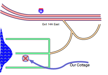
A popular technique is to draw in the overlay mode to annotate the existing platte or terrain image. By placing the imported image or scanned reference map on a second layer, you may freely draw in the overlay mode to add elements to the existing map. This is a good way to communicate proposed changes or property improvements.
Layers Drawer
Your drawing may be organized with a layering or overlay technique. Each drawing window has its own drawer for individual control over the position and drawing attributes of each layer.
Element Snapping
The Grids and Guides palette provides several methods for snapping graphic elements together. Intersections on a map drawing is a good example of the use of this capability. Any number of "road" ends may come together at an intersection, the snapping capability will precisely mate the individual elements to form a clean intersection.
Wall Inspector
EazyDraw's Wall Inspector palette gives you full control over the detailed form of each "road" graphic element. You may numerically define the width of the road, the join form for intersections, the shape of free ends (open, square, pointed or round).
for macOS Sequoia through Big Sur, see support page for other solutions.
One download and install. Try it out, purchase a license code.